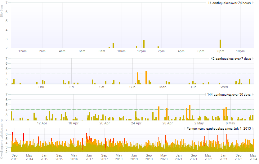

*In the water 22 km south of Castlecliff, Manawatu-Wanganui, New Zealand
The energy chart shows how much energy has been released on a daily basis since July 1, 2013 and also a count of how many earthquakes have occurred each day
The depth chart shows the depth of the earthquakes and the magnitude of the earthquakes over time.
The weekly chart shows the number of earthquakes per week over magnitude 3 and the maximum magnitude per week
Allows you to browse the quakes with details and map locations using the up and down arrow keys.
The earthquake drum represents one day's recording of the seismometer located in Wellington.
The search page allows you to search for earthquakes anywhere in New Zealand. You can filter on location, magnitude and date ranges.
The following show the top 100 earthquakes around Wellington, New Zealand and the world on a map.

